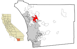
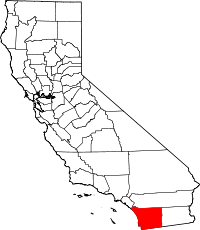
Escondido, California
| Escondido | |
|---|---|
| — City — | |
| City of Escondido | |
 |
|
| Nickname(s): Hidden Valley; The Hidden City; The Heart of San Diego North; Esco | |
 |
|
| Coordinates: | |
| Country | |
| State | |
| County | San Diego |
| Incorporated | October 8, 1888 |
| Government | |
| - Type | Council-Manager |
| - Mayor | Lori Holt Pfeiler |
| Area | |
| - Total | 36.5 sq mi (94.5 km2) |
| - Land | 36.3 sq mi (94.0 km2) |
| - Water | 0.2 sq mi (0.5 km2) |
| Elevation | 646 ft (197 m) |
| Population (Jan. 2010) | |
| - Total | 147,514 |
| - Rank | 4 |
| - Density | 3,681.4/sq mi (1,421.4/km2) |
| Time zone | PST (UTC-8) |
| - Summer (DST) | PDT (UTC-7) |
| ZIP Code | 92025-92027, 92029 |
| Area code(s) | 760 and 442 (overlay plan) |
| FIPS code | 06-22804 |
| GNIS feature ID | 1652706 |
| Website | www.ci.escondido.ca.us |
Escondido (pronounced /ˌɛskənˈdiːdoʊ/ "es-cone-DEE-doe") is a city located in California, just north of the city of San Diego. The name means "hidden" in Spanish—it occupies a shallow valley ringed by rocky hills. Founded in 1888, it is one of the oldest cities in San Diego County. The city has an estimated population of 144,831.[1] The city is known as Eskondiid in Diegueño.[2] A nationwide study in 2005 ranked Escondido #11 out of 25 of the most conservative cities in America.[3]
Contents |
History
The Escondido area was first settled by Native American tribes. The Luiseño established campsites and villages along the creek running through the area. They named the place "Mehel-om-pom-pavo". The Kumeyaay migrated from areas near the Colorado River, settling both in the San Pasqual Valley and near the San Dieguito River in the southwestern and western portions of what is now Escondido. Most of the villages and campsites today have been destroyed by development and agriculture.[4]
Spain controlled the land from the late 1700s to the early 1800s, and established many missions in California to convert the indigenous people. When Mexico gained its independence from Spain, the local land was divided into large "ranchos." Most of Escondido occupies the former Rancho Rincon del Diablo. Rincon del Diablo ("Devil's Corner") was a Mexican land grant given to Juan Bautista Alvarado (distinct from the governor of the same name) in 1843 by Governor Manuel Micheltorena. Alvarado was a Regidor of Los Angeles at the time, and the first Regidor of the pueblo of San Diego. In addition, the southern area of Escondido occupies the former Rancho San Bernardo, granted in 1842 and 1845.[5].
The Mexican-American War began in 1846. The Battle of San Pasqual was fought southeast of Escondido, pitting Mexican Andrés Pico (brother of then-California-governor Pío Pico) against Americans Stephen W. Kearny, Archibald Gillespie, and Kit Carson. A park in Escondido is named for Carson.
In 1853, there was a proposal backed by pro-Southern Copperheads to divide the state of California, creating a new Territory of Colorado (at this time the territory that would become the state of Colorado was still named Jefferson). San Diego Judge Oliver S. Witherby predicted that the capitol of the new territory would be located in Rancho Rincon del Diablo. He envisioned a railroad connecting San Diego to Fort Yuma through an area about two miles south of the current Escondido site, heading east through San Pasqual. He planned to profit off the town that he believed would form from the dividing point on the railroad below the eastern hills.[6] With a series of deeds in 1855 and 1856, the rancho was transferred from the heirs of Juan Bautista Alvarado to Witherby.[5]
The proposal for splitting the state and creating the new territory passed in the California legislature, but died in Congress in the run-up to the Civil War.[5] It was effectively killed in 1861 when Congress organized the Territory of Colorado in the area previously occupied by the Jefferson Territory. With Witherby's vision of owning a bustling state capitol unrealized, he set up a mining operation on the rancho instead.[6]
In 1868, Witherby sold the rancho for $8000 to Edward McGeary and John, Josiah, and Matthew Wolfskill. McGeary owned one half of the rancho, while the three Wolfskill brothers each owned an equal share of the other half. John Wolfskill farmed sheep, horses, and cattle on the rancho for a number of years. Wolfskill had frequent conflicts with the Couts family, owners of the neighboring Guajome, Buena Vista, and San Marcos ranchos, over grazing lands and watering holes.[5]
Incorporation and growth
The city was home to a large Spanish-speaking population in the first census back in 1850, but after the US won the war, non-Hispanic settlers came to Southern California in increasing numbers. The decade of the 1880s is known as the "Southern California Land Boom" because so many people were moving to the state.
In October 1883, a group of Los Angeles investors purchased Rancho Rincon del Diablo. This group sold the land to the newly-formed Escondido Company in 1884. On December 18, 1885, investors incorporated the Escondido Land and Town Company, and in 1886 this company purchased the 12,814-acre (52 km2) area for approximately $100,000. [5] Two years later, in 1888, Escondido was incorporated as a city - the vote was 64 in favor of cityhood with 12 votes against. Railroads like the Santa Fe and Southern Pacific were laid in the 1880s, and the opening of U.S. Route 395 in 1930 boosted economic growth in Escondido.
Escondido was primarily an agricultural community, growing muscat grapes initially. After a dam was built in 1894-5 to form what is known today as Lake Wohlford, oranges and lemons were planted in large quantity, as well as a number of olives and walnuts. By the 1960s avocados became the largest local crop. Since the 1970s, Escondido has lost most of its agricultural landscape to new housing developments.
Through the 20th century the community grew and the economy diversified. Today the community has approximately 140,000 residents, and an economy based on agriculture, tourism, retail, services, light industry, and high tech. Escondido no longer has a large lower-middle-class population as it once had: most of this socioeconomic group had to move elsewhere when housing prices soared and older neighborhoods were bulldozed or renovated. Escondido has a high real estate appraisal rating, a phenomenon in North San Diego County since the population began to rise steadily in the 1970s.
Geography
Escondido is located at 33°7'29" North, 117°4'51" West (33.124794, -117.080850).[7]
According to the United States Census Bureau, the city has a total area of 94.5 km² (36.5 mi²). 94.0 km² (36.3 mi²) of it is land and 0.5 km² (0.2 mi²) of it is water. The total area is 0.52% water.
The city is growing at a rapid rate with new communities like Hidden Trails appearing at the east end of East Valley Parkway. The city proper is surrounded by several sparsely populated unincorporated communities. These include Jesmond Dene and Hidden Meadows to the north; Felicita Park to the southwest; and Rincon Del Diablo to the southeast. Residents of these communities have Escondido mailing addresses and zip codes, and they are sometimes assigned to Escondido schools, but they cannot participate in city elections.
The city contains several neighborhoods including:
- Downtown Escondido centers around Grand Avenue between Centre City Parkway and Palomar Hospital. The city's general plan defines the Downtown Specific Plan Area as approximately 460 acres (1.9 km2) bounded by Centre City Parkway on the west, Hickory and Ivy Streets on the east, Washington Avenue on the north, and Fifth Avenue on the south, with an additional narrow section extending west along Valley Parkway to Interstate 15. [8]
- Old Escondido is bounded by Escondido Boulevard on the west, Chestnut Street on the east, Fifth Avenue on the north, and Thirteenth Avenue on the south. This area is made up of mostly single-family residential housing.[9]
The community of Valley Center is located just north of Escondido. Valley View Casino, owned by the San Pasqual Band of Diegueno Mission Indians, is located in Valley Center.
Climate
Escondido tends to have warmer summers and wetter winters than its neighbor San Diego. Yearly precipitation averages around 15 inches and varies from year to year. More than 80% of all precipitation takes place from November through March. Snow is very uncommon. Climate is mild enough to allow widespread cultivation of avocados and oranges. Escondido is located in a plant hardiness zone 9.
| Climate data for Escondido | |||||||||||||
|---|---|---|---|---|---|---|---|---|---|---|---|---|---|
| Month | Jan | Feb | Mar | Apr | May | Jun | Jul | Aug | Sep | Oct | Nov | Dec | Year |
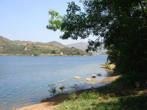
Lakes
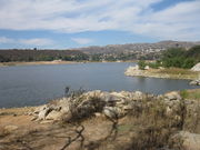
Three lakes are located in or near Escondido, all of which allow boating and fishing:
- Dixon Lake is located in the north.[10]
- Lake Wohlford is located on the north eastern fringe of the city limits.[11]
- Lake Hodges is located just south of the city. A part of Lake Hodges is crossed by Interstate 15 via the Lake Hodges Bridge. Often this part of the lake is dry.
Demographics
| Historical populations | |||
|---|---|---|---|
| Census | Pop. | %± | |
| 1890 | 541 |
|
|
| 1900 | 755 | 39.6% | |
| 1910 | 1,334 | 76.7% | |
| 1920 | 1,789 | 34.1% | |
| 1930 | 3,421 | 91.2% | |
| 1940 | 4,560 | 33.3% | |
| 1950 | 6,544 | 43.5% | |
| 1960 | 16,377 | 150.3% | |
| 1970 | 36,792 | 124.7% | |
| 1980 | 64,355 | 74.9% | |
| 1990 | 108,635 | 68.8% | |
| 2000 | 133,559 | 22.9% | |
| Est. 2008 | 144,568 | 8.2% | |
As of the 2000 census, there are 133,559 people, 43,817 households, and 31,153 families residing in the city. The population density is 1,421.4/km² (3,680.9/mi²). There are 45,050 housing units at an average density of 479.4/km² (1,241.6/mi²). According to the 2000 census, the racial makeup of the city is 51.9% White, 2.25% African American, 1.23% Native American, 4.46% Asian, 0.23% Pacific Islander, 19.19% from other races, and 4.81% from two or more races. Hispanic or Latino of any race were 38.7% of the population.[12]
There are 43,817 households of which 39.1% have children under the age of 18 living with them, 53.9% are married couples living together, 28.9% are non-families, and 11.7% with a female householder with no husband present. 22.4% of all households are made up of individuals and 10.1% have someone living alone who is 65 years of age or older. The average household size is 3.01 and the average family size is 3.50.
In the city the population is spread out with 29.7% under the age of 18, 10.4% from 18 to 24, 31.4% from 25 to 44, 17.5% from 45 to 64, and 11.0% who are 65 years of age or older. The median age is 31 years. For every 100 females there are 98.4 males. For every 100 females age 18 and over, there are 96.1 males.
The median income for a household in the city is $42,567, and the median income for a family is $48,456. Males have a median income of $32,627 versus $27,526 for females. The per capita income for the city is $18,241. 13.4% of the population and 9.3% of families are below the poverty line. Out of the total population, 17.9% of those under the age of 18 and 5.7% of those 65 and older are living below the poverty line.
The city can be divided into two demographically distinct areas. Peripheral hilly areas to the north, southeast, and southwest are relatively wealthy and populated by non-Hispanic whites, and flat areas adjacent to the downtown are predominantly Hispanic. As of 2006-07 school year, non-Hispanic white children comprise 71.7% of all students in Bernardo Elementary School (southwest), 60.8% of all students in L.R. Green Elementary School (southeast), and 54.7% of all students in Reidy Creek Elementary School (north); on the other hand, Farr Avenue, Pioneer and Lincoln Elementary schools (three large schools just north of the downtown) all have more than 85% of Hispanic and less than 6% non-Hispanic white students.
Crime
In 2008, there were 567 violent crimes and 4,182 property crimes in Escondido. There were 4 murders and non-negligent manslaughters, 31 rapes, 195 robberies, 337 aggravated assaults, 898 burglaries, 2,405 larceny thefts, 879 vehicle thefts, and 27 arsons.[13]
In 2007, the city ranked #65 by violent crimes per capita and #58 by property crimes per capita among 165 cities in California with populations greater than 50,000. Compared with 12 largest cities in San Diego County, it ranked 6th in both categories. Its crime rate was lower in both categories than in San Diego, El Cajon, and National City; higher in both categories than in San Marcos, Carlsbad, Encinitas, and Santee. Escondido had higher violent crime rates but lower property crime rate than La Mesa and Chula Vista, lower violent crime rates but higher property crime rates than Vista and Oceanside.
Economy
Residents work in a range of industries. Out of the approximately 64,000 employed civilian residents over the age of 16, 15% work in educational, health care and social services; 13% in retail trade; 13% in construction; 12% in professional, scientific, management, administrative, and waste management services; 11% in arts, entertainment, recreation, and accommodation and food services; 11% in manufacturing; and 11% in other services.[14] Palomar Medical Center is the city's largest employer, followed by the Escondido Union School District and the City of Escondido itself.[15]
Arts and culture
Downtown
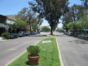
Downtown has become more active in the past few years with the opening of restaurants, cafes, and galleries. Every Friday night from April through September, the Downtown Business Association hosts the popular "Cruisin' Grand," where the public can show and view hot rods and historic cars. A different car club and/or featured attraction (i.e. antique fire trucks, nitro night, midget and sprint cars) is highlighted each week. Cruisin' Grand also features a DJ, hula hoop contests for children, and 7 trophies each night.
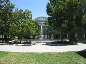
In addition to the many art galleries on Grand, a branch of the Mingei International Museum has recently opened there. This museum displays handcrafts from around the world. Just one block off Grand Ave. is Grape Day Park with the civic center and the California Center for the Arts, Escondido that features two theaters, a visual arts museum, an educational complex, and a conference center. The Escondido Children's Museum and the Escondido History Center, two independent non-profit museums, are located in Grape Day Park. The Children's Museum features hands-on exhibits and programs for children up to 10 years of age, with an authentically regional perspective on natural and social science. The History Center features the city's original Santa Fe Depot, first library, Victorian house, barn, and blacksmith shop. The Pioneer Room of Escondido Public Library (located in the Mathes Center building next to the Main Library) has photographs, maps, oral histories, genealogical collections, directories and yearbooks documenting Escondido's history.[16] The San Diego North Convention & Visitors Bureau [1] is located in the California Center for the Arts, and sells half price arts performances and is the only ARTS TIX outlet in San Diego North. The Visitors Bureau also provides literature, maps, and their Travel & Planning Guide free of charge to visitors.
Sports
From 1964–1968, the San Diego Chargers, then of the now-defunct AFL, held training camp in Escondido.[17]
In 1981, Escondido National Little League became the 19th[18] team to make it to the Little League World Series from the state of California. The team was first District 31 champions, then District 8 champions.[19] They then won the Southern California Divisional Tournament at Youth Athletic Park by beating San Bernardino Civitan 3-2 in the quarterfinals, then beating Granada Hills American 5-1 in the semifinals and then beating Ladera National 7-5 in the finals to earn a trip to the Western Regional. At the Western Regional in San Bernardino, the Escondido team won four straight games to earn the trip to Williamsport.[20]
Parks and recreation
Parks
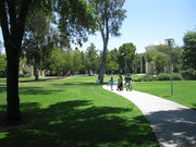
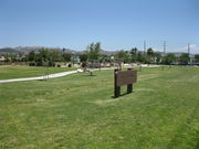
Escondido has 13 parks.[21]
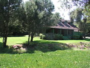
- Daley Ranch is a 3,058-acre conservation area acquired in 1996 by the City of Escondido and is managed in perpetuity for the preservation of a biologically unique and diverse habitat area of regional importance. Daley Ranch has over 20 miles of hiking, mountain biking, and equestrian trails. Six distinct trails cover most of the property. Most popular are the Boulder Loop Trail (2.4 miles) which affords views of Escondido, and the Ranch House Loop (2.5 miles), which passes two small ponds and the site of Daley's original log cabin.
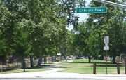
- El Norte Park is a small "green lung" park, off El Norte Parkway in northern Escondido. It features mature trees and a kids playground.
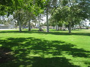
- Grape Day Park is located behind the Escondido city hall and the performing arts complex. Grape Day park was named after the annual grape day harvest, an event held on the first Saturday after Labor Day.
- Jesmond Dene
- Kit Carson: Queen Califia's Magical Circle, the last major international work by French artist Niki de Saint Phalle, is located in Kit Carson Park. De Saint Phalle, a colleague of Salvador Dalí and Jasper Johns, is best known for her Stravinsky Fountain, located in Paris, France. The artist chose Escondido as the site for her final work because it reminded her of Italy.

- Dixon Lake supplies Escondido with fresh water. Swimming is not allowed, but fishing is, and boats are available for hire. Dixon Lake has about 34 camp sites which look out over the lake, or over Escondido. While entrance to the park is free, the city charges $5.00 (in 2010) for taking a car into the park. However, ample free parking is available outside the gate.
- Lake Wohlford is in the north east corner of Escondido. The lake has some walking trails around the perimeter, and allows fishing.
- Mountain View
- Rod McLeod
- Washington Park is an urban park located on the eastern side of central Escondido. It features two swimming pools, and enough grass to kick a ball around. The park's numerous mature trees create plenty of shady areas.
- Westside
- Ryan Park
- Grove Park was so named to recognize the city's agricultural history and was built about 2008 (approximate date). It is about 4.5-acres in size and is located in the Mission Park neighborhood.
Wild Animal Park
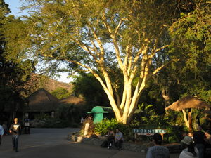
A major tourist attraction just outside Escondido is the San Diego Wild Animal Park, sister park of the San Diego Zoo. The Wild Animal Park shows world animals in open habitat, where they can roam, graze, and fly.
Stone Brewing Company
In 2006, Stone Brewing Company moved its headquarters and brewery from San Marcos, California to a new, much larger facility in the Quail Hills area of Escondido.[22]
Deer Park Buddhist Monastery
Deer Park Monastery is a Buddhist sanctuary that occupies 400 acres in the hills north of Escondido and west of Daley Ranch. It is one of the two monasteries in the United States under the direction of a well known Zen teacher Thich Nhat Hanh. Deer Park Monastery is home to 27 Buddhist monks and nuns, and it frequently hosts events and retreats that bring people from all over the western United States and from abroad.
Government
| Sister cities[23] |
|---|
| Maebaru, Japan |
Local
Escondido is governed by a mayor-council system. The city council consists of a mayor and four City Council Members. Along with the City Treasurer, they are elected at large to four-year terms. The current mayor is Lori Holt Pfeiler. Current City Council Members are Sam Abed, Olga Diaz, Dick M. Daniels, and Marie Waldron. The current City Manager is Clay Phillips. The current City Treasurer is Ken Hugins. The most recent election was held on November 7, 2006.[24] Mayor Lori Holt Pfeiler won 59% of the vote, defeating challenger Tim Dagosta. Council member Marie Waldron led the seven-way race for city council, after basing her re-election platform on a controversial housing ordinance that seeks to ban the city's illegal immigrant population from renting apartments. The ordinance is being challenged by the ACLU in court and might be ruled unconstitutional under California law. Retiring council member Ron Newman was replaced by newcomer Dick Daniels. Issues in the municipal election included managing growth and improving opportunities for business and recreation.
Due to the public outcry and legal challenges to the aforementioned housing ordinance, and the election of Olga Diaz to the City Council, it has since ceased any overt attempts to lower the illegal immigrant population in the city (which, by council member Sam Abed's estimates, possibly constituted as much as 35,000, or 25% of the city population in 2006[25]), and focused on "quality of life" issues instead. Periodic police checkpoints are instituted to catch unlicensed drivers. An active area of debate is an overnight parking ordinance that would limit the number of cars each household can legally park on city streets.[26] The city is estimated to have lost as much as a quarter of its non-citizen population between 2006 and 2007. Latino activists attribute this to a perception of the city as hostile to immigrants.[27]
State and Federal
In the state legislature Escondido is located in the 38th Senate District, represented by Republican Mark Wyland, and in the 74th and 75th Assembly District, represented by Republicans Martin Garrick and Nathan Fletcher respectively. Federally, Escondido is located in California's 50th congressional district, which has a Cook PVI of R +5[28] and is represented by Republican Brian Bilbray.
In the United States presidential election of 2008, 53.3% of voters residing in incorporated Escondido voted for John McCain, 44.9% voted for Barack Obama, and 1.8% voted for one of the third-party candidates. Unincorporated areas were considerably more conservative: among voters in neighborhoods of Rincon Del Diablo, Hidden Meadows, and Valley Center, 62.3%, 65.5%, 66.9% of voters respectively cast their votes for John McCain.
Education
Escondido is served by the Escondido Union School District,[29] the Escondido Union High School District,[30] and the San Pasqual Union School District. The city has 19 elementary, five middle, and seven high schools.
Public high schools:
- Escondido High School
- Orange Glen High School
- San Pasqual High School
- Classical Academy High School
- Escondido Charter High School
- Center City High School
- Valley High School[31]
Middle schools:
- Bear Valley Middle School
- Del Dios Middle School
- Hidden Valley Middle School
- Mission Middle School
- Rincon Middle School
There is a wide range of API scores for Escondido schools, reflecting the demographic diversity of the city. As of 2009,[32] two elementary schools in the district scored above the 80th percentile of all schools in the state, and nine elementary schools scored below the 20th percentile.
The Escondido Public Library system consists of the Main Branch, the East Valley Branch, Pioneer Room, Computer Center, and a bookmobile.
Infrastructure
Transportation
Two highways serve Escondido: Route 78 and Interstate 15. Route 78 enters from the west as a freeway which ends at Broadway. The highway follows surface streets and leaves the city heading east into the San Pasqual Valley.
The North County Transit District (NCTD) operates local bus service, with the Escondido Transit Center serving as a hub. The transit center has connections to both the San Diego Metropolitan Transit System and the Riverside Transit Agency.
The Sprinter light rail line, operated by NCTD, links the transit center to Oceanside using the existing 22-mile (35 km)-long Escondido Branch trackage of the San Diego Northern Railroad. The rail line opened in 2008, making Escondido one of the first cities in the United States to operate Desiro-class diesel multiple units manufactured by Siemens in Germany. At the Oceanside Transit Center, the Sprinter connects to three commuter rail lines (the Coaster, the Metrolink Orange County Line, and the Metrolink Inland Empire-Orange County Line) and Amtrak's Pacific Surfliner regional rail line.
The California High Speed Rail Authority listed Escondido as a stop along the proposed high speed rail system running from Southern to Northern California.[33] A section of the line between San Francisco and Los Angeles was approved by voters in the November 2008 elections.
Utilities
San Diego Gas & Electric is the electric utility for the city.[34] The Rincon del Diablo Municipal Water District serves Escondido.[35]
Health care
Palomar Medical Center is a hospital located east of downtown Escondido. It is the only designated trauma center in northern San Diego County.[36] A second hospital, Palomar West, is under construction southwest of the interchange between Interstate 15 and State Route 78. It is scheduled to open in 2012.[37]
Notable natives and residents
- Anacani: featured singer with Lawrence Welk orchestra
- Tom Anderson: co-founder of MySpace[38]
- Lester Bangs: rock music critic
- Benjamin Britten: English composer, famous for his opera "Peter Grimes"[39]
- E. H. Bronner: soapmaker
- Pete Coscarart: former Brooklyn Dodger
- Gavvy Cravath: right fielder for the Philadelphia Phillies
- Richard Denning: actor
- Mike Esparza: 94.9 radio personality, host of The Mikey Show
- Brittany Hogan: former Miss California
- Vanessa Hudgens: Star of High School Musical.
- Randy Johnson: former Major League player with Atlanta Braves, current Special Asst to Oakland A's GM Billey Beane, Graduate of Escondido High School
- Jovan Kirovski: forward for the L.A. Galaxy MLS team
- Elisabeth Kübler-Ross: founder and resident of the Shanti Nilaya retreat in Escondido in the late '70s and early '80s
- Shannon MacMillan: professional soccer player and graduate of San Pasqual High School
- Deborah Jeane Palfrey: the so-called D.C. Madam[40]
- Mark Redman: professional baseball player and graduate of Escondido High School
- Steve Reeves: bodybuilder[41]
- Travis Ryan: lead vocalist of Cattle Decapitation[42]
- Sean Salisbury: former ESPN anchorman and former NFL quarterback; graduate of Orange Glen High School
- Diego Sanchez: guitarist for Disgorge
- Randy Vasquez: actor
- Eric Weddle: #32 of San Diego Chargers resides in Escondido[43]
- Harold Bell Wright: author in 1920s and 1930s
See also
- North County Times
- The Road to Escondido, an album by J.J. Cale, Colin Tappe and Eric Clapton
References
- ↑ Escondido: City of Choice. "Escondido at a Glance. City of Escondido Demographics." City of Escondido, n.d. Web. 29 March 2010.
- ↑ Ted Couro and Christina Hutcheson (1973), Dictionary of Mesa Grande Diegueño, Malki Museum Press, Morongo Indian Reservation, Banning, California
- ↑ Study Ranks America’s Most Liberal and Conservative Cities.govpro.com.
- ↑ "The History of Escondido". Escondido Public Library. Archived from the original on March 15, 2007. http://web.archive.org/web/20070315105101/http://www.library.escondido.org/pioneer/history.htm. Retrieved August 5, 2010.
- ↑ 5.0 5.1 5.2 5.3 5.4 Rush, Philip S. (1965). "Rincon del Diablo". Some old ranchos and adobes. San Diego, California. pp. 46, 47. LCCN 65-21995.
- ↑ 6.0 6.1 Stanford, Leland G. (1978). "Devil's Corner and Oliver S. Witherby". Journal of San Diego History (San Diego History Center) 24 (2). https://www.sandiegohistory.org/journal/78spring/corner.htm. Retrieved August 5, 2010.
- ↑ "US Gazetteer files: 2000 and 1990". United States Census Bureau. 2005-05-03. http://www.census.gov/geo/www/gazetteer/gazette.html. Retrieved 2008-01-31.
- ↑ "II. Land Use". City of Escondido General Plan. 1990-06-06. pp. 141, 142, 169. http://www.ci.escondido.ca.us/depts/cd/planning/genplan/sections/section-2.pdf. Retrieved 2010-03-29.
- ↑ "II. Land Use". City of Escondido General Plan. 1990-06-06. p. 18. http://www.ci.escondido.ca.us/depts/cd/planning/genplan/sections/section-2.pdf. Retrieved 2010-03-29.
- ↑ "Dixon Lake". City of Escondido. http://www.ci.escondido.ca.us/glance/lakes/dixon/index.html. Retrieved 2010-02-21.
- ↑ "Lake Wohlford". City of Escondido. http://www.ci.escondido.ca.us/glance/lakes/wohlford/index.html. Retrieved 2010-02-21.
- ↑ http://censtats.census.gov/data/CA/1600622804.pdf censtats.census.gov
- ↑ California - Offenses Known to Law Enforcement by State by City, 2008
- ↑ "C24050. Industry by occupation for the civilian employed population 16 years and older". 2006-2008 American Community Survey 3-Year Estimates. U.S. Census Bureau. http://factfinder.census.gov/servlet/DTTable?_bm=y&-context=dt&-ds_name=ACS_2008_3YR_G00_&-_geoSkip=0&-CONTEXT=dt&-mt_name=ACS_2008_3YR_G2000_B24050&-tree_id=308&-_skip=0&-redoLog=false&-geo_id=16000US0622804&-search_results=01000US&-_showChild=Y&-format=&-_lang=en&-_toggle=ACS_2008_3YR_G2000_B24050. Retrieved August 1, 2010.
- ↑ "Top 25 Employers - City of Escondido". City of Escondido. 2008-06. http://www.ci.escondido.ca.us/econdev/largest-emp.pdf. Retrieved 2009-08-28.
- ↑ Pioneer Room
- ↑ "Chronology 1959-1969". San Diego Chargers. http://www.chargers.com/team/history/chronology/1959-1969.html. Retrieved 2009-09-28.
- ↑ West Region State Little League Champions
- ↑ 1981 Southern California Little League Tournament Results
- ↑ 1981 Little League World Series Rosters
- ↑ "Facilities and Park Directory" (PDF). City of Escondido. http://www.ci.escondido.ca.us/recreation/facilities/directory-map.pdf. Retrieved 2010-02-21.
- ↑ Fikes, Bradley J. (2006-03-05). "Stone Brewing Co. grows in Escondido". North County Times. http://www.nctimes.com/business/article_abd07f96-d6aa-5469-b743-2eaa958a6b92.html. Retrieved 2010-05-24.
- ↑ "Escondido Sister City — Maebaru, Japan". City of Escondido. http://www.ci.escondido.ca.us/glance/uniquely/sister/index.html. Retrieved 2008-06-30.
- ↑ General Municipal Election
- ↑ "Escondido to vote on housing ordinance". San Diego Union Tribune. http://www.signonsandiego.com/news/northcounty/20061004-9999-7m4illeg.html.
- ↑ City delays adoption of parking ordinance
- ↑ Fox, Zach (2008-09-23). "Escondido faces another fiscal obstacle: fewer people". North County Times. http://www.nctimes.com/business/article_057ab19c-65c4-5d81-a452-11a8b4ffe8c5.html. Retrieved 2010-05-24.
- ↑ "Will Gerrymandered Districts Stem the Wave of Voter Unrest?". Campaign Legal Center Blog. http://www.clcblog.org/blog_item-85.html. Retrieved 2008-02-10.
- ↑ Escondido Union School District
- ↑ Escondido Unified High School District
- ↑ Valley High page at EUHSD
- ↑ (2009) 2009-10 Accountability Progress Reporting (APR). California Department of Education. (Report). Retrieved July 31, 2010.
- ↑ (2009) Notice of Preparation of a Project Environmental Impact Report/Environmental Impact Statement (EIR/EIS) for the California High-Speed Train Project from Los Angeles to San Diego via the Inland Empire, CA. California High-Speed Rail Authority. (Report). Retrieved July 31, 2010.
- ↑ "Our Service Territory". San Diego Gas and Electric. http://www.sdge.com/aboutus/serviceTerritory.shtml. Retrieved 2010-02-14.
- ↑ "Our History". Rincon del Diablo Municipal Water District. http://www.rinconwater.org/our_history.htm. Retrieved 2010-02-14.
- ↑ "Palomar Medical Center". Palomar Pomerado Health. http://www.pph.org/PPHContentPage.aspx?nd=170. Retrieved 2010-02-14.
- ↑ Sisson, Paul (June 5, 2010). "Hospital's facade takes shape". North County Times. http://www.nctimes.com/news/local/escondido/article_d0aff227-78c0-5568-9f18-953cf4cf9c7b.html. Retrieved August 1, 2010.
- ↑ Angwin, Julia (2009-03-29). "Putting Your Best Faces Forward". The Wall Street Journal. http://online.wsj.com/article/SB123819495915561237.html. Retrieved 2010-02-14. "Born Nov. 8, 1970, he grew up in Escondido, a sleepy farm town about a half hour's drive north of San Diego."
- ↑ Britten, Benjamin (2004). "I. Towards Peter Grimes". In Mitchell, Donald; Reed, Phillip; Cooke, Mervyn. Letters from a life: the selected letters and diaries of Benjamin Britten. Volume three (1946–51). Berkeley and Los Angeles: University of California Press. p. 90. ISBN 0-520-24259-9. "Britten and Pears spent much of July and August 1941 in Escondido, staying with the piano duo Ethel Bartlett (1896–1978) and Rae Robertson (1893–1956)."
- ↑ Eastman, Quinn (2007-05-09). "Escondido a quiet corner of 'D.C. Madam's' life". North County Times. http://www.nctimes.com/news/local/escondido/article_4ae2dbd7-5bdd-5199-a4d9-511988044d59.html. Retrieved 2010-02-14. "Deborah Jeane Palfrey, the woman recently accused by federal prosecutors of running a Washington, D.C., prostitution business by phone from California, owns a house in Escondido, but her neighbors said last week that it provided her a quiet refuge, rather than a remote command post."
- ↑ Lyman, Rick (2000-05-05). "Steve Reeves, 74, Whose 'Hercules' Began a Genre". The New York Times. http://www.nytimes.com/2000/05/05/us/steve-reeves-74-whose-hercules-began-a-genre.html. Retrieved 2009-07-15. "After he stopped making films in 1969, the couple raised horses at their ranch near Escondido, northeast of San Diego."
- ↑ Ryan, Travis. Interview with Aaron Schmidt. Cattle Decapitation. Thrasher Magazine. January 15, 2009. Retrieved on July 31, 2010.
- ↑ Sullivan, Mike (July 20, 2007). "Weddle wants to get out of the house". North County Times. http://www.nctimes.com/sports/football/professional/nfl/chargers/article_18a5f7f2-752c-51d5-a63a-3f0fc979f0e4.html. Retrieved July 31, 2010. "Eric Weddle recently moved into a house in Escondido."
External links
- City of Escondido · Official Website
- North County Times newspaper
- Escondido Public Library
|
||||||||||||||||||||||
|
|||||||||||||||||
|
|||||||||||||||||